The Klondike Highway is 715 km/445 mile highway that connects Skagway Alaska to Whitehorse and Dawson City Yukon, the heart of the Klondike Gold Rush in 1898.
Beginning in Skagway, the South Klondike Highway climbs steeply for 22 km/14 miles to the 3,292 foot/1003 m summit of the White Pass near the Alaska/Canada border.
It is 174 km/108 miles from Skagway to Whitehorse, and a further 541 km/336 miles from Whitehorse to Dawson City.
The Klondike Highway roughly parallels the route taken by the prospectors in the 1898 Klondike Gold Rush. It was a grueling journey from Skagway over the Chilkoot Pass or the White Pass to Carcross. From there, prospectors continued by boat or raft along the Yukon River, through Whitehorse to Dawson City.
The last section of the Klondike Highway was built from Skagway to Carcross in 1978 and is known as the South Klondike Highway. As the highway winds out of Skagway towards Whitehorse you will encounter beautiful lakes and rivers including the stunning Emerald Lake at km 117 (57 km south of Whitehorse). The South Klondike Highway is part of the Golden Circle Route, a journey that travels from Whitehorse to Skagway, Haines and Haines Junction. Continue on the Ferry from Haines to Juneau and include Alaska’s beautiful capital city on your journey. In 1986 the highway became important as a commercial trucking route, with the abandonment of the White Pass Railroad from Carcross to Whitehorse.
Fraserway RV Rentals, a Canadian and family-owned company since 1969, are an excellent way to explore the Klondike Highway. Rent an RV in Whitehorse and drive south to Skagway on the South Klondike Highway or Drive north to Dawson City to discover the Klondike.
Klondike Highway Highlights
White Pass & Yukon Railway
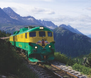
The White Pass & Yukon Railway in Skagway is one of the most popular attractions in Alaska. Board this historic train and enjoy the journey into the past. The train follows the route that the gold seekers took from Skagway to Carcross, Yukon. Learn more…
Fjord Express to Juneau
Experience the best of Alaska’s Inside Passage in just one day from Skagway or Haines. This spectacular day cruise to Juneau and back includes whale watching, cascading waterfalls, Lynn Canal, a Juneau City Tour and Eldred Rock Lighthouse. Cruise aboard the Fjordland, a state of the art, high speed catamaran. Learn more…
For a complete list of Things to do in Alaska and the Yukon, visit our Things To Do section.
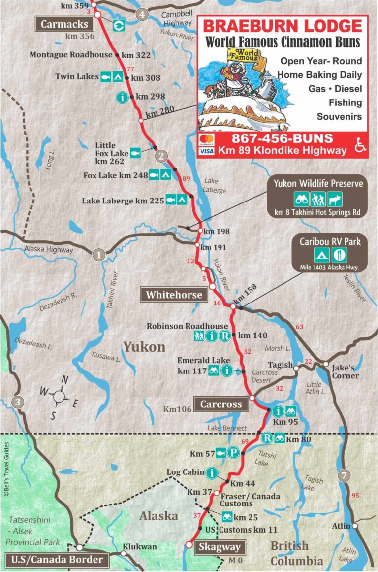
The only population center between Skagway and Whitehorse is the community of Carcross.
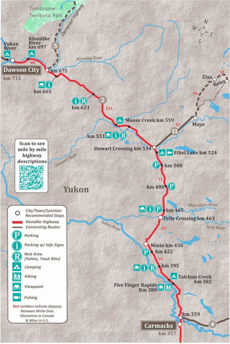
There are several small communities between Whitehorse and Dawson City, including:
- Carmacks,
- Minto,
- Pelly Crossing, and
- Stewart Crossing.
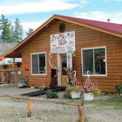
Braeburn Lodge
at km 280. Don’t miss this favorite stop on the way to Dawson City. It is home to world famous cinnamon buns, monster sandwiches, great fishing and souvenirs. 89 km from the Alaska Highway junction. Gas & Diesel available. 867-456-2867
Carmacks
Carmacks is at the junction of the Klondike Highway and the Robert Campbell Highway, which leads to Faro and Watson Lake. In 1893 George Carmack, who would later discover gold in Dawson, found coal near Five Finger Rapids and went about developing a coal mine.
Carmack built a cabin, which became a trading post and the community of Carmacks was born. It wasn’t long before it became an important riverboat stop between Whitehorse and Dawson City.
The settlement continued to grow when the Overland Trail was routed through Carmacks in 1901. In 1955 a branch road was completed from Carmacks to Dawson. This ended Sternwheeler traffic and resulted in the demise of many small river communities, however, Carmacks was one of the few to survive.
To determine when you should plan your trip to the Yukon and Alaska, visit our page on the best time to visit Alaska.
Finally, many visitors to the Yukon and Alaska want to experience the Northern Lights, so we’ve put together a page of detailed information on how and when to see the Northern Lights.
Dawson City
Dawson City, is the heart of the world-famous Klondike Gold Rush of 1898. As many as 60,000 annual visitors come to Dawson, some looking for gold, others to explore it’s rich history. Discover more of Dawson City.
Diamond Tooth Gerties Gambling Hall
Diamond Tooth Gertie’s Gambling Hall is Canada’s first and friendliest casino Gertie’s has been wowing visitors with its unique Klondike period style, nightly cancan entertainment, and friendly charm for decades.
Bonanza Gold RV Park
One mile from Dawson’s city center on the Klondike Highway. Kitchenette, Queen & Double rooms. All rooms have a free Wi-Fi, mini fridge, microwave, coffee maker and air conditioners or fans.
Raven’s Nook
Specializing in unique souvenirs, T-shirts, and sportswear, men’s and ladies fashions and a great selection of footwear make this Dawson City’s mini-Department Store.
Bonanza Market
Fresh meat & locally grown produce, dairy and a complete line of groceries including a fresh Deli with a great selection. 2nd Ave. & Princess St. 867-993-6567
Mackenzie Petroleum
Truck and RV accessible pumps and propane filling service. 103 Callison Way, off the Klondike Highway, 6 km before reaching Dawson City. 867-993-5445
Klondike Highway FAQS
Is the Klondike Highway Paved?
Yes, the entire length of the Klondike Highway is paved, from Skagway to Dawson City. However, there are sections of gravel due to construction between Stewart Crossing and Dawson City.
Can you drive from Skagway to the Yukon?
Yes, you can drive from Skagway to the Yukon on the South Klondike Highway. The South Klondike Highway is the section of the Klondike Highway from Skagway to the Alaska Highway (16 km south of Whitehorse). The North Klondike Highway starts 12 km north of Whitehorse and is 524 km to Dawson City, in the Yukon.
How long is the Klondike Highway?
The Klondike Highway is 715 km from Skagway to Dawson City.
The South Klondike Highway is 158 km from Skagway to the Alaska Highway.
The North Klondike Highway is 524 Km from The Alaska Highway to Dawson City.
There is also a 33 km section between the South and North Klondike Highway that is actually on the Alaska Highway.
How far is Dawson City from Skagway?
Dawson City is 715 km North of Skagway.
Klondike Highway Maps
The two Klondike Highway Maps below, show the highway divided into two sections. The first section shows from Skagway to Carmacks. The second map shows from Carmacks to Dawson City.
