0
Dawson Creek is “Alaska Highway Mile 0” and has a population of approximately 11,000. Dawson Creek is also the end of the Hart Highway, which starts in Prince George. There is a commemorative Alaska Highway Mile 0 marker near the traffic Visitor Center. The Alaska Highway is 2,224 Km/1382 miles long to Delta Junction, Alaska. From Delta Junction it is another 98 miles to Fairbanks Alaska, on the Richardson Highway. For a complete list of Things to do in BC, the Yukon and Alaska on your trip north, visit our Things To Do section.
Dawson Creek Visitor Info Centre
Provides travel information on Dawson Creek, the Yukon and Alaska as well as Alberta and Northwest Territories. www.tourismdawsoncreek.com
2.4
Mile 0 RV Park, Walter Wright Pioneer Village.
3.2
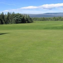
Dawson Creek Public Golf Course.
5.3
Parking.
12.1
Parking.
14
Farmington Fairways and Campground 250-843-7774, 9-hole par 36 golf course, driving range, licensed clubhouse, rentals. Campground pull throughs with hook-ups, firepits, tables, pit toilets and sani station.
16.5
Parking on right northbound.
23.6
Farmington Store. Fuel, groceries and liquor.
25.8
Kiskatinaw Provincial Park. Turn onto Old Alaska Highway for 5 km. This is a loop road, however, the historic curved wooden trestle bridge is currently closed dues to instability. Visitors will need to drive in and out the same way. The Provincial Park has 28 camp sites, water, firewood, tables and fishing.
29.3
Parking on right northbound
31.9
Kiskatinaw River Bridge. Parking on right northbound.
34
Old Alaska Highway to Kiskatinaw River Bridge. Excellent viewpoint for photos of the Historic curved wooden bridge. The bridge is currently closed to traffic.
45.7
Rest area for Southbound traffic only.
47.5
Rest area and Brake check. Parking on both sides of highway at top of hill overlooking the Peace River. Litter bins and toilets.
49.8
Parking with view of Peace River Valley.
52.8
Peace Island Provincial Park. Picnic tables and boat launch.
53.6
Peace River Bridge. 712 meters
56
(HM 36) Taylor
Population 1200. Gas, groceries, accommodations, post office, restaurants. Nestled on the banks of the majestic Peace River, Taylor offers a wide variety of recreation and amenities. A $40 million natural gas scrubbing plant & oil refinery are here at the beginning of a 700-mile natural gas pipeline which supplies Vancouver & western Washington.
Taylor Visitor Info Centre
On the left when heading north at 10316 100 St. Stop in and ask the staff for local recommendations for camping, hotels and things to do in Taylor. 250-789-9015
https://districtoftaylor.com/visitor-centre/
63
Fort St. John Airport.
71
Free dump station on right northbound.
75.6
(HM 48) Fort St. John
The largest city in the Peace River North region, and a transportation hub for the Peace. Oil and gas, forestry and agriculture are also important to the local economy. Ft. St. John is 75 kilometres from Alaska Highway Mile 0 in Dawson Creek.
Fort St John Visitor Info Centre
Whether it be camping, fishing, golfing, boating or hiking the energetic staff will help you discover all there is to do in and around the City. fortstjohn.ca/tourism
79.5
Beatton Provincial Park, 8 km side road. 37 camp sites.
81
Charlie Lake, gas, accommodations.
86
Junction with Highway 29. Access the town of Hudson’s Hope (80 km) and Chetwynd (144 km), (at the junction of the Hart Highway). You can also access the The 600-ft. high W.A.C. Bennet Dam across the Peace River valley which created the 640-square mile Williston Lake, the largest lake in BC.
86
Charlie Lake Provincial Park. Turn east on the paved loop road. 58 Sites, picnic tables, kitchen shelters, outhouses and RV dump station. Water and parbage containers. Camping fees.
96
Parking.
105.2
Parking.
115
The Shepherd’s Inn (HM 72)
126
Rest Area, tables, toilets and playground.
162
Wonowon (HM 101)
This small highway settlement is the gateway to a vast wilderness of mountains, rivers and lakes accessed by the Alaska Highway. Formerly known as “Blueberry,” Wonowon was the site of a traffic control gate during World War II.
183.6
Parking, litter barrel.
218
Parking.
226
Buffalo Inn (HM 143) has clean, modern motel units, an RV park with hookups & laundromat. This is the only Pub between Fort St. John and Fort Nelson. 250-731-6747
226
Pink Mountain (HM 143)
229
Parking.
231.9
Sasquatch Crossing Lodge (HM 147) Open year round. Cabins, gifts and souvenirs. The restaurant features daily specials with home-cooking. 250-731-6747.
232.9
Beatton River.
233.4
Parking.
250.5
Rest area and brake check.
256.2
Sikanni Chief River Bridge. Spring fishing for grayling. Fall fishing for pike.
256.5
Sikanni River Campground & RV Park offers access to riverside camping in serviced and unserviced sites. Some pull-though sites, Wi-fi, laundry, washrooms, showers and playground. Regular gas available (no diesel or propane). Open May – Sept. 250-772-5400
258.2
Parking and brake check.
278.4
Buckinghorse River, Provincial Park (HM 175)
Fee area, 33 camp sites, tables, toilets, drinking water. Swimming and fishing in river.
279
(HM 175) Buckinghorse River Lodge RV parking (no hookups). There is a full service restaurant with home-style cooking and friendly service. Wi-fi & satellite TV. Gas, diesel & propane The Historical Buckinghorse River Lodge is found on the left northbound and this is the recommended stop. 250-772-4999
282.5
Parking, litter barrel.
284.2
Redfern-Keily trailhead.
293
Large parking area, litter barrel.
320
Rest Area with large parking area, litter barrels and toilets.
357.7
Bougie Creek, parking.
359
Bougie Creek, parking.
364.7
Prophet River (HM 233)
365.5
Adsett Creek, parking and litter barrel.
374.5
Parking, litter barrel.
379.9
Parking, litter barrel.
419.3
Large parking area, litter barrel.
425.1
Jackfish Creek.
426.5
Andy Bailey Provincial Park, access by 12 km gravel road. Day-use area, 5 campsites, (not recommended for large vehicles) water, picnic tables, toilets, beach, swimming and boat launch. No turnaround area.
434.6
Natural Gas processing plant.
451
Muskwa River Bridge. Lowest point on highway 1,000 ft. Muskwa is Indian for “bear”, and the area has many.
454
Fort Nelson Population 5,900, is a thriving community with an economy historically based on forestry, oil & gas, and an emerging tourism sector. Located 454 Kilometres from Dawson Creek and Mile 0 of the Alaska Highway.
Fort Nelson Visitor Info Centre
Stop by to pick up a free copy of the Northern Rockies Travel Guide or ask the travel advisors for more information about travel in Northern BC. www.tourismnorthernrockies.ca
