Bob Quinn Lake Maintenance Camp. No services. Access to Bob Quinn Lake, tables, toilets.
303.5Parking both sides of highway.
307Devil Creek Bridge.
308Parking.
314Thomas Creek Bridge.
318.3Parking.
320Slate Creek.
321.7Parking.
324Durham Creek.
330.7Brake Check.
332.7Burrage River. One-lane bridge, parking.
333.3Viewpoint overlooking Iskut River.
335Scenic viewpoint..
336.5Brake check, emergency airstrip crosses road.
345.3Rest area with picnic tables and toilets beside Eastman Creek.
350.2Rescue Creek, narrow bridge.
353.1Willow Ridge Resort, visitor facilities.
353.6Willow Creek.
356.6Parking.
357.8Natadesleen Lake trail head 1km/.6 mile to lake, parking with toilets.
360.9Parking.
363Snapper Creek.
365Kinaskan Lake Provincial Park Campground 50 sites, water, picnic area, fire pits, handicap accessible toilets, hiking trail and boat launch. Fishing. Fee area.
367.7Gravel southbound to km 330.2/mile 205.2, paved northbound to km 427.
370Parking beside Kinaskan Lake.
373Parking beside Kinaskan Lake.
375.6Small parking area.
377.8Parking.
378.3Todagin Creek.
390.2Tatogga Lake Resort, gas, meals, cabins, campground.
391Coyote Creek.
396.5Eddontenajon Lake, rest area, boat launch, fishing for trout.
400Iskutine Lodge, 250-234-3456.
405.5 Iskut Small Native community. Visitor facilities. Post office, general store, gas. 408.4Mountain Shadow Guest Ranch, RV Park & Campground. 1 km side road.
413.9Bear-Paw Ranch.
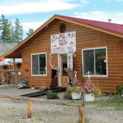
415.2Trappers Souvenirs.
423Morcheau Lake, rest area with tourist map and services directory.
424.9Morcheau Lake BC Forest Service campsite.
427Paved southbound to km 365/mile 226.8. Gravel northbound to km 446.
429.8Brake check.
436.1Parking with tourist map for Iskut Lakes Recreation area.
436Stikine River Bridge, roads on both sides of bridge lead to river, parking and boat launch.
440.2Parking.
443.5Brake check.
446Gravel southbound to km 427/mile 265.3–paved northbound to km 502.9.
452.5Parking by Tee’s Creek.
457.5Parking.
461.2Rest area at Upper Gnat Lake. Fair rainbow fishing. Beautiful camping spots by the lake.
463.8Parking at Lower Gnat Lake. Fair rainbow fishing.
467Parking.
468.4Gnat Pass Summit, 1141 meters/4071 ft.
479Rest area.
479Rest area beside Tanzilla River, fishing for grayling. Dease Lake Lions Tanzilla River Campground on the Tanzilla River.
481.1Dalby Creek.
484Parking beside river.
487.1Arctic Pacific Divide.
488Rest area, sign on Arctic Pacific Crossroads, 820 m/2690 feet.
488.3Dease Lake BC
Junction of Cassiar Highway with Telegraph Creek Road.This road is 112.8 km/70 miles long and leads to Telegraph Creek at the head of Stikine River and is not suitable for large vehicles or vehicles towing trailers.
There are no services along the road but Telegraph Creek has a gas station, store, RCMP station, post office. Check locally for road conditions.