354
Carmacks has accommodations, a grocery store, laundromat, post office, fuel and a Yukon government campground. Carmacks is at the junction of the Klondike Hwy and the Robert Campbell Highway, which leads to Faro and Watson Lake. In 1893 George Carmack, who would later discover gold in Dawson City, found coal near Five Finger Rapids and went about developing a coal mine. Carmack built a cabin, which became a trading post and the community of Carmacks was born. It wasn’t long before it became an important riverboat stop between Whitehorse and Dawson. The settlement continued to grow when the Overland Trail was routed through Carmacks in 1901. In 1955 a branch road was completed from Carmacks to Dawson. This ended sternwheeler traffic and resulted in the demise of many small river communities, however, Carmacks was one of the few to survive.
357
Coal Mine Lake Road, at south end of bridge, 2.3 mile trail leads to Coal Mine Lake.
357.1
Yukon River Bridge.
359.1
Campbell Highway Junction (Yukon Highway 4) which connects Watson Lake and Carmacks.
360.4
Coal Mine hill, parking.
380
Five Finger Rapids Recreation site. Hiking trails, picnic spot, tables, toilets. Information sign.
382.4
Tatchun Creek Yukon Government Campground. 12 campsites, kitchen shelter, fishing.
395.2
Yukon Crossing Rest area. Information signs on the Beringia land mass.
403.4
McGregor Creek.
422.5
McCabe Creek, parking.
429
Minto Resort Road.
430
A short road leads to Minto, site of old settlement. In 1898, the Yukon River froze up and many goldseekers, forced to winter here, starved to death. Minto Airstrip.
448.8
Rock Island Lake.
463
Pelly Crossing (pop. 290). Small First Nations settlement, post office, gas station, grocery store, RCMP detachment, Yukon government campground and dump station. The Selkirk Heritage Centre can be found near the grocery store.
463.6
Pelly River Bridge. This bridge replaced the ferry crossing in 1958.
465
Parking with litter barrels and information signs on the development of the area.
466.7
Pelly Airstrip.
480
Parking.
507.8
Parking.
521.4
Crooked Creek Rest Area. Grayling and Pike fishing.
523.7
Ethel Lake Road. Parking, narrow winding road leads 24 km/15 miles to Ethel Lake and Yukon government campground (not recommended for large RV’s). 12 camp sites, boat launch, fishing.
534.8
Stewart Crossing. Junction at north end of bridge. Silver Trails Information Center and rest area at south end of bridge. Highway 11 heads northeast to Mayo, Elsa and Keno. The road is paved to Mayo and gravel to Keno. This was one of Canada’s richest silver mining areas it is 51 km/32 miles to Mayo and another 61 km/38 miles to Keno. This area was widely prospected in the early 1900’s, but it was the strike of Louis Bouvette in 1919, that made the area famous.
545.4
Dry Creek.
551
Stewart River view point. Rest area with picnic tables and information signs.
558.6
Moose Creek Lodge.
558.9
Moose Creek Bridge.
559.3
Moose Creek Yukon government campground, 36 camp sites, water, picnic shelter, hiking trails, playground. Fee area. Good grayling fishing.
580.4
McQuestern River Bridge.
590.7
McQuestern Airport.
594
Clear Creek.
609
Clear Creek road
617.7
Willow Creek.
621
Rest area with information signs.
627.6
Meadow Creek.
628
Rest area.
634.5
French Creek.
639.7
Stoneboat swamp.
655.2
Tintina Trench Look-Out. Rest area.
664.4
Flat Creek Bridge.
668.2
Historic sign about the Klondike River and the Dempster Highway.
674.7
Dempster Highway Junction. The Dempster Highway is 742 km/461 miles to Inuvik, an Eskimo village high above the Arctic Circle.
684.1
Goring Creek.
696.7
Klondike River Campground, water, picnic shelter, playground, hiking trails. Fee area.
697.5
Dawson City Airport.
700.2
Hunker Creek Road.
702.7
Bear Creek Road.
703.7
Parking with Information signs on tailing piles and the Yukon Ditch.
709
Callison Subdivision.
711.6
Bonanza Road to Discovery Claim and Historic Dredge No 4 operated by Canadian Heritage Parks Canada. Tours available 9 to 5 daily June through August admission fee.
711.8
Bonanza Gold Motel & RV Park.
712.2
Klondike River Bridge.
713.4
Dome Road.
714
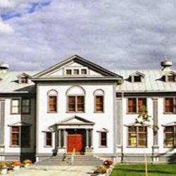
Dawson City probably has more things for visitors to see and do than any town in the Yukon or Alaska. It is host to a number of annual events inluding Discovery Days Festival, which celebrates the Discovery of Gold in 1896. Visit the Commissioner’s Residence and the Boyhood Home of Pierre Berton. The Yukon Gold Panning Championships are hosted on July 1st and Goldpanners attend from around the world and compete in various panning categories.
The Visitor Information Center
Historic slide shows and films are shown daily and interesting artifacts are on display. Drop by and pick up a Dawson City map to plan your path through this historic city or join one of the many Parks Canada Walking Tours and be guided around town by a costumed guide reliving the Klondike era. www.dawsoncity.ca
