36.5
Canadian Customs Station at Fraser. Open 24 hours. All vehicles must stop for inspection. View of Fraser Lake.
36.8
Fraser, rest area with information sign.
38.5
Parking.
40.6
Parking with toilets.
41.2
Parking.
43
Parking with view of Tormented Valley.
44
Highway crosses rails of White Pass and Yukon Railway at Log Cabin. This is the exit point for the Chilkoot Trail so there are always hikers in this area. Large parking area with information signs.
46
Pull off.
46.7
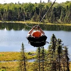
Yukon Suspension Bridge.
57
The next 13 km provides a view of Tutshi (too-shy) Lake. The highway parallels the lake and there are numerous parking areas along the road.
64.3
Side Road on right (for northbound) leads to boat launch and undeveloped picnic area on Tutshi Lake (not recommended for large vehicles).
70
Parking with view of Tutshi Lake.
80.1
BC/Yukon Border. Rest area with view of Windy Arm.
83.4
Parking. Remains of an Historic Mill from old Venus Mine. Mill operated for 6 months in 1910 before mine shut down.
84.5
Pooly Creek.
85
Parking.
86.7
Venus Mine. Ore storage bin and foundation of old mill.
90
Conrad Campground. 29 campsites, picnic shelters, water. On the shore of Tagish Lake’s Windy Arm.
95
Parking with historical sign and view of Bove Island in Tagish Lake.
98.3
Parking.
104
Nares Lake.
105.2
Nares River Bridge. Spans narrows between Bennett Lake and Tagish Lake. On left (for northbound), you can see railroad bridge for White Pass & Yukon Route.
105.6
Carcross, pop. 430. Services include: Airstrip, Caribou Hotel, gas, store, police, post office.
106.2
Carcross Yukon government campground, 12 camp sites, water, tables. Fee area.
106.4
Junction with Yukon Highway #8 which leads to Tagish, Atlin Road and Alaska Highway at Jake’s Corner. Visitor facilities.
107.7
Point of interest sign on the Carcross Desert, parking. Most Canadians have never heard of Carcross Desert. The Yukon is home to the smallest desert in the world, less than 260 hectares. This desert is the remains of the sandy bottom of a glacial lake left after our last ice age. The dry climate and the strong wind conditions is what created the sand dunes and what allows little vegetation to grow.
109
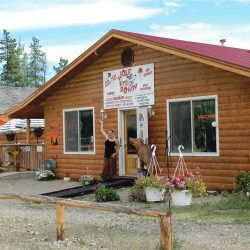
Caribou Crossing Trading Post and Wildlife Gallery. They have a wildlife museum with the world’s largest polar bear and a life-size woolly mammoth, a Mountie Museum, dog cart rides and gold panning. There’s also a café with sandwiches, soups, and local coffees. An affordable admission rate gives you access to the museums, a visit with their adorable husky puppies, and a stroll through the petting farm. 867-821-4055
115.5
Spirit Lake Wilderness Resort, visitor facilities.
116.9
Spirit Lake.
117.5
View Point at Emerald Lake with Point of Interest sign. One of the most beautiful lakes in the Yukon.
120
Small Pullout.
128.6
Side road leads to Lewes Lake 2 km/1.2 miles. Fishing for grayling & Lake Trout.
136.7
Rat Lake.
139.7
Robinson Roadhouse Historical Site, Rest area with view of Robinson, once a stop on the White Pass and Yukon Route. The town was named for Stikine Bill Robinson, an early day adventurer.
152.3
Kookatsoon Lake recreation day use area.
157.8
(km 1404.4 Alaska Highway) Junction with Alaska Highway. This is not the end of Klondike Highway 2. It joins the Alaska Highway for the next 34 km/21 miles before branching off towards Dawson City Yukon.
Actual Alaska Highway mileage markers are in Brackets.
161.4
(km 1408.2 A.H.) Wolf Creek Public Campground. Well water, toilets, tables, kitchen shelter, playground, hiking trails and fishing. Fee area.
169
(km 1414.7 A.H.) Pioneer RV Park. Full service RV Park. 867-668-5944 or 1-866-626-7383 for reservations. 5 minutes to downtown Whitehorse.
170
(km 1416.2 A.H.) Side Road. One-half mile to Miles Canyon and suspension footbridge. Past the footbridge the road follows the shoreline of Schwatka Lake until, just past the hydro dam, it joins the main, south access route into Whitehorse.
171
(km 1417.9 A.H.) Philmar RV Service. Complete RV repair. They have a large parts department and specialize in coach repairs, fabrication and welding on any size rig. 867-668-6129
172.5
(km 1419 A.H.) Rest stop.
172.9
(km 1419.4 A.H.) Hi Country RV Park.
172.9
(km 1419.4 A.H.) Whitehorse. South access to downtown via Robert Service Way. Whitehorse is The Capital of the Yukon and offers unparalleled access to the surrounding wilderness. Over two-thirds of the Yukon’s residents live in Whitehorse, which has a year-round population of about 36,000.
Yukon Visitor Reception Centre
This is a great place to start your visit to Whitehorse as there are many staff available to answer questions and tons of information on the surrounding areas. www.tc.gov.yk.ca/vic.html
175.8
(km 1422.3 A.H.) Beringia Interpretive Centre.
176.5
(km 1423 A.H.) Airport Chalet
176.5
(km 1423 A.H.) Whitehorse Airport.
179
(km 1425.5 A.H.) Junction. Two Mile Hill leads to Whitehorse city center.
180.5
(km 1426.9 A.H.) Kopper King
189.5
Rest Stop.
190.5
(Km 1437 A.H.) Junction of Klondike Highway 2 and Alaska Highway. It is 526 km/327 miles to Dawson City. If you go to Fairbanks via Dawson City it is 1160 km/721 miles. It is only 200 km/124 miles further to go to Fairbanks via Dawson City rather than taking the Alaska Highway. We recommend you include the trip to Dawson City as part of your travels.
195.5
Takhini River Bridge.
197.8
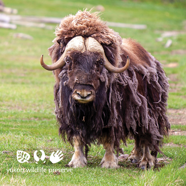
Takhini Hot Springs Road. This 12 km side road will take you to the Yukon Wildlife Preserve. The former Takhini Hot Springs facility at the end of the road is closed and a newly designed project called Eclipse Nordic Hot Springs will take it’s place. It is scheduled to open in 2022.
The Yukon Wildlife Preserve.
208.7
Shallow Bay Road.
212.1
Horse Creek.
224
Deep Creek.
224.6
Lake Laberge Yukon government campground (pronounced Labarge). 3 km/1.9 mile, 22 camp sites, well water, tables, firepits, toilets, boat launch. Fee area. 30 mile-long lake that becomes rough quickly on a windy day. Lake Trout, grayling and pike in the lake.
228.3
Fox Creek. Fishing for grayling.
239
Scenic view of Fox Lake, boat launch.
247.7
Fox Lake Yukon government campground, 33 camp sites, picnic area, water, firepits, fire wood, playground, boat launch swimming. $8 fee. Fishing for Lake Trout, burbot and grayling.
262.2
Parking beside little Fox Lake. Trout fishing.
272
Rest Area.
280
(HM 55) Braeburn Lodge, world famous cinnamon buns, home baking fresh daily. Gas, camping, fishing and canoe rental. Open year round. On the Trans-Canada Trail system. Handicap accessible.
298
Rest area, Point of interest. Conglomerate Mountain.
308
Twin Lakes Yukon government campground, 19 camp sites, water, tables, and toilets and boat launch. Fee area. Good fishing for pike, grayling and lake trout.
322.4
Rest area, the remains of Montague House, one of over 50 roadhouses that were found along the stagecoach trail between Dawson City and Whitehorse.
352
Parking
354.5
Rest Area with information signs.
356
Carmacks has accommodations, a grocery store, laundromat, post office, fuel and a Yukon government campground. Carmacks is at the junction of the Klondike Hwy and the Robert Campbell Highway, which leads to Faro and Watson Lake. In 1893 George Carmack, who would later discover gold in Dawson City, found coal near Five Finger Rapids and went about developing a coal mine. Carmack built a cabin, which became a trading post and the community of Carmacks was born. It wasn’t long before it became an important riverboat stop between Whitehorse and Dawson. The settlement continued to grow when the Overland Trail was routed through Carmacks in 1901. In 1955 a branch road was completed from Carmacks to Dawson. This ended sternwheeler traffic and resulted in the demise of many small river communities, however, Carmacks was one of the few to survive.
