42.2
Junction with Knik-Goose Bay Road. Wasilla. Access to Hatcher Pass via Main Street, which becomes Wasilla Fishhook Road. Wasilla Fishhook Road also leads to the Iditarod Headquarters, 2 km from the Parks Highway. Turn left when headed north.
43.7
Best Western Lake Lucille Inn
47
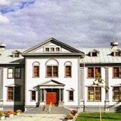
The Museum of Alaska Transportation and Industry
52.2
Junction with Big Lake Road leads to Big Lake Recreation area, one of the major recreational areas for Southcentral Alaska, and is easily accessible by highway. Turn West at mile 52 on the Parks Highway, and drive 3.6 miles to Fishers Y. Keep to the left and you will come to East Lake Mall. Groceries, pizza, liquor store. From Fishers Y, paved and unpaved roads lead to Big Lake, Beaver Lake, Rocky Lake, Horseshoe Lake, and numerous campgrounds. The lakes are connected by dredged waterways. Fishing is good for rainbow, lake trout, Dolly Varden, burbot, and landlocked salmon. If you’re piloting your own plane, Big Lake has a good airstrip and is only a short flight from Anchorage. Most area resorts provide land and/or water taxi service. Motor and sailboats are for hire at the recreational marinas and resorts. Guide services are also available.
57
Bridge over Little Susitna River, parking. Fair rainbow fishing and good for king, red, humpie, and silver salmon in season. June through September. There is a good boat launch available to the public.
57.4
Houston has all visitor facilities, groceries, restaurant, post office, campground, and lodging by the Little Susitna River, excellent fishing and riverboat services available.
Little Susitna River Campground. Fee area. The river is famous for its world-class sport fishing. Little Susitna Public Use Facility offers camping and boating access. The area is heavily forested with spruce and birch. A general store food, showers, storage, and gas is located within five miles of the campground. This is not an Alaska State Park, but is managed as one. Exit is on the east side of the highway.
66.5
Nancy Lake State Recreation Site. 30 camp sites is on the northeast shore of Nancy Lake, a popular fishing and boating area near Willow (67 miles from Anchorage, 30 miles north of Wasilla). A picnic area and a boat launch are also on the site. Electric hookups, phone. Fee area.
The 700-acre lake has fair fishing for rainbow and Dolly Varden, with occasional catches of silver salmon, whitefish, and burbot.
69
Willow, population 1600 has a post office and a local airport.
70.8
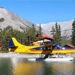
Airport and float plane dock
70.8
Willow Creek State Recreation Area has a 100 camp sites,64 with electrical hookups, water,modern restrooms,, hiking trails. Fee area. Fishing access to Willow Creek and its confluence with the Susitna River. There is excellent salmon fishing in the Willow area .
71.2
Junction with Willow Fishhook (Hatcher Pass) Road 49.5 miles. For a beautiful drive on some of the highest, most spectacular, and wildest roadway in the state. After about 13 miles of pavement, you’ll negotiate some rough conditions up and over the mountains-peaking at Hatcher Pass (3,886 feet). This old mining area is scenic, rich in history, and offers great hiking and berry picking. Hatcher Pass Road is 49 miles total and continues west to Palmer on the Glenn Highway.
71.5
Lower Willow Creek. Rainbow, silver salmon. Only creek in area that is navigable to the Big Susitna River.
72.1
Parking
74.7
Little Willow Creek. There is fair summer-fall fishing for trout & salmon in season. Parking.
76.4
Kashwitna Lake; large parking area.
81.2
Large gravel parking area on both sides of highway at Grey’s Creek. Fishing.
81.3
Parking.
82.3
Susitna Landing State Recreation Area. boat launch, campground, RV park, restrooms, showers, fishing. Fee area.
83.2
Kashwitna River and bridge, there are large parking areas at both ends of the bridge.
84
Large parking area. Public access road to Caswell Creek.
85.1
Caswell Creek.
87.9
Gigglewood Lakeside Inn, Vacation Rentals.
88.5
Sheep Creek.
89
Parking on both side of the highway.
93
Parking.
93.5
Goose Creek, parking.
96.4
Montana Creek State Recreational Site. 36 campsites, good for all RV sizes. Toilets, water, picnic sites, fishing and hiking trails.
98.7
Cubby’s Marketplace. The only full-service supermarket on the Parks Highway north of Big Lake.
98.8
Talkeetna Junction. Paved road leads 14 miles to Talkeetna. Speedway fuel station and convenience store at the junction.
Talkeetna was established as a mining town and trading post before Wasilla or Anchorage existed. The Talkeetna and Chulitna Rivers join the Susitna River at the end of Main Street and the town takes its name from an Indian word K’Dalkitnu, meaning, “rivers of plenty.”
102.1
Parking.
104.2
Big Susitna River, State wayside, tables, fires pits and toilets.
104.7
Parking.
105.8
Rabideaux Creek bridge
114.6
Trapper Creek Inn visitor services.
115
Community of Trapper Creek. Before the Susitna River was bridged, miners and homesteaders crossed the river on winter ice and forged their way up the Petersville mining road.
115.5
Vitus-Trapper Creek – ATM, Liquor Store, hot showers, ice cream, restaurant, cabin rentals and laundry facilities.
121.6
Parking .
126.5
Parking.
127
Parking.
132.2
Denali State Park. The park is undeveloped for the most part. Several nature trails are found in area to the 2,000-ft. butte at the back of Byers Lake. The view from the butte is great.
The park is bordered by the Talkeetna Mountains and Alaska Range. The latter protects the area from the extreme winter cold of the Interior (to the north). The diverse landscape of the park is dominated by Curry and Indian ridges, which form a rugged 30-mile spine for the length of the park. Small terrace and upland lakes are found along the rock ridges. Numerous high points overlook the Alaska Range.
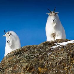
The park is a game refuge but you may not see any animals during the summer. Moose retreat to higher elevations as the snow melts, and the bear prefers his natural habitat. Sheep inhabit only the alpine regions and caribou cross the highway only in winter when they migrate.
132.8
Chulitna River, parking.
133
Mt. McKinley Princess Wilderness Lodge.
134.5
Mary’s McKinley View Lodge.
134.7
Denali Viewpoint South, large parking area with excellent view of Mt. McKinley. Telescopes, toilets, water pump, trail, camping.
137.2
Lower Troublesome Creek and trailhead, 20 campsites, picnic sites, water, picnic shelters, toilets. Trails and fair trout and salmon fishing, some grayling. Fee area.
137.6
Upper Troublesome Creek Trailhead.
mile 143.8 Byers Creek.
145.7
Parking.
147
Byers Lake Campground. 73 camp sites, picnic sites, water, toilets, trails, fishing and boat launch. Cascade Ridge Trail leads up Curry Ridge from campground. Lake is not open to motorized boats. Berries in the area are abundant. Fee. area. There are a lot of bears in this area so be careful.
147.1
Alaska Veterans Memorial and rest area. Tables, toilets, water and picnic shelters and trails.
156.5
Ermine Hill Trailhead, parking.
159.4
Parking.
159.9
Horseshoe Creek, small parking area by creek.
161
Parking.
162.4
Denali Viewpoint North. Large parking area.
162.7
Denali View North campground, 20 camp sites, picnic sites, water, fire pits, toilets. Hiking trail, interpretive signs, viewing telescope. Fee area. Handicap accessible.
163.2
Little Coal Creek, parking at south end of bridge.
163.9
Little Coal Creek trailhead and parking. Toilets and hiking trail.
165.6
Parking on both sides of highway by small stream.
168.5
Denali State Park Northern Boundary.
170
Scenic viewpoint, parking.
173
Parking, viewpoint.
174
Hurricane Gulch. This 550-foot bridge is 260 feet above Hurricane Creek. Parking at both ends of bridge. Parks Highway opening ceremonies held here October 14, 1971.
176
Parking.
176.6
Parking.
178.1
Honolulu Creek, parking on both sides of the creek.
179.5
Parking beside lake.
180
Parking beside lake.
183.1
Large parking area. Views over the Chulitna River of the Alaska Range.
184.5
Parking.
185.1
East Fork of the Chulitna River.
185.8
East Fork Chulitna State Wayside. Picnic tables, shelter, water, firewood, fire pits, toilets.
187.5
Parking.
188.5
Igloo City, no services.
191.1
Large parking area.
194
Broad Pass separates the Chulitna and Nenana River basins and divides the Susitna and Yukon River watersheds. Elevation is 2300 ft.
194.5
Middle Fork Chulitna River. Parking at south end of bridge.
195.9
Parking with good views of Denali (Mt. McKinley) and Broad Pass.
201
Large parking area. View of Denali (Mt. McKinley).
203.6
Large parking area.
208
Pass Creek, parking.
209.5
Jack River.
210
Junction with The Denali Highway. Head east for 133 miles to Paxson (mile 185.5 on the Richardson Highway). The Denali Highway is a true wilderness highway and it is usually rough and dusty. Most rental vehicles are prohibited from driving the Denali Highway.
210
Cantwell. 2 miles west of the Parks Highway. Population approximately 200.
Vitus – Cantwell – ATM, Liquor Store, snacks, clean restrooms.
211.5
Parking
213.9
Parking
215.7
Nenana River bridge
216.1
Parking
218.6
Parking
219.7
Parking
220.7
Large Double Ended Parking by Nenana River
222.2
Parking
224
Carlo Creek bridge. Visitor facilities
228
Parking
229
Denali Cabins
229.5
Denali Air
229.8
Parking
231
Denali Grizzly Bear Resort.
231.1
Nenana River. Denali National Park Boundary.
234.1
Parking area, scenic view.
237.2
Riley Creek.
237.3
Denali National Park and Preserve Entrance. Take the Park Road to the Denali Visitor Center, the Wilderness Access Center and Riley Creek Campground. Private Vehicles are only allowed to drive 15 miles into the park without a permit. Regular shuttle buses leave from the Visitor Center and take people into The Park.
237.9
Nenana River Bridge
238
Parking Access to walking bridge that crosses the Nenana River
238
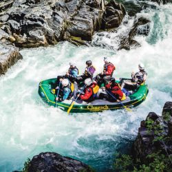
Denali Raft Adventures and Denali Riverside Cabins.
238.2
Kingfisher Creek.
238.5
Denali Townsite. the Denali town site is only a 1 mile past the entrance to Denali National Park. The town is where you will find, hotels, restaurants, fuel, shopping and tour operators.
There are four Visitor Centers in Denali Park.
www.nps.gov/dena/planyourvisit/visitorcenters.htm
Denali National Park & Preserve Information Center is at mile 1.5 of the Denali Park Road and provides natural and cultural history exhibits, ranger programs, and screenings of the award-winning park film “Heartbeats of Denali.” 907-683-2294
The Wilderness Access Center & Backcountry Information Center, is located at mile one of the Denali Park Road. It provides information, reservations, and permits for park campgrounds, tour & shuttle buses, and overnight backcountry trips.
The Murie Science and Learning Center is run by National Park Service in partnership with Alaska Geographic and other organizations. It’s goal is to increase scientific literacy by showcasing research from living laboratories like Denali National Park.
Eielson Visitor Center, Mile 66 on the Park road. You can reach Eielson Visitor Center by shuttle bus. The center has incredible views of Denali on a clear day. It has artistic and interactive exhibits. Rangers are on hand to answer questions.
Hotels & Camping
Things To Do
